
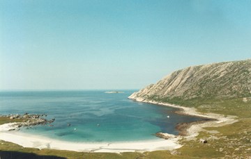
Styvi is one of the four hamlets or main farms along the Nærøyfjord. It consists of two farms and the "spring farm" of Hølmo. In addition, the farm has the right to have a mountain farm and pastures at Hjølmo and Vassete at Dyrdal, on the opposite side of the fjord. Before the Nærøyfjord area was designated as a world heritage site, a landscape protection area was established from Styvi to Holmo in 1991.

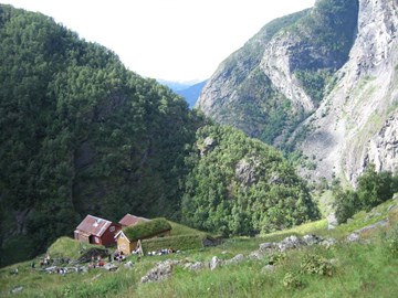
A small greenstone (greenschist) axe from the Stone Age may be an indication that there has been a settlement since prehistoric times in the village of Dyrdal on the Nærøyfjord. Other finds, such as a burial mound at the farm Drægo and a field of three burial mounds at the Dyrdal farm dating from the Younger Iron Age all point in the same direction. The hamlet is known for its cluster farmyard down by the fjord and for the hospitality offered to hikers on the high farm of Drægo. In the hamlet that once had more than 100 inhabitants, there are at present no farms in operation.
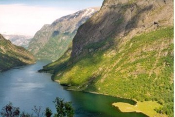
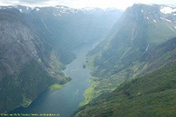
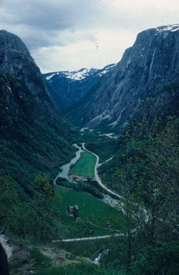
Gudvangen is located at the very head of the Nærøyfjord, covering a distance from Stalheim in the western part of the valley of Nærøydalen to Dyrdal further out the fjord. The village includes the farms of Ramsøy, Gudvangen, Skjerpi, Hemri, Hylland and Solbjørgo. From the 1800s, the village has been known for its built-up area by the quay, its accommodation establishments, posting station as well as trade.
The small hamlet of Bakka consists of the farms Bakka and Tufto. In the Nærøyfjord these two farms on the right-hand side are the last two farms that the boat passes on her way to the head of the fjord at Gudvangen. The hamlet is probably best known for its white church, designed by the architect Christian Henrik Grosch, who was also responsible for large parts of the urban development in the capital Christiania (Oslo). The hamlet is also known for tis World Heritage Tour with its starting point between Bakka and Tufto.
"The people who live above this lake are called 'Vassbygder' and the parish stretches eastwards up to the road leading to the valley of Hallingdal in the Akershus diocese across a part of the mountain area called Filefjell (sic - actually Holsfjellet). Their dead people can only be taken down to the Vangen churchyard by being carried along narrow footpaths and frightening abysses. The corpses have to carried on horseback without coffins in a so-called "kjesse" - a contraption consisting of two strong wicker mats - until they come down to the lowland where the deceased can finally be placed in coffins".(From the vicar Wigeboe's report on Vassbygdi and the valley of Aurlandsdalen in the 1790s).
The hamlet of Stalheim consists of the farms Stalheim, Brekke, Sivle and Sivlesøy in the municipality of Voss. The hamlet can be looked upon as a gateway to the valley of Nærøydalen and the area included in the World Heritage Nærøyfjorden. The name Stalheim is probably linked to the steep hillside called Stalheimskleiva, meaning "the farm at Stadall", derived from the verb "standa, stå" (stand).
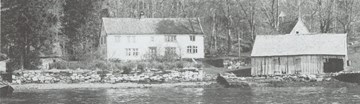
The Hellevik farm is situated at the strait of Stongasundet just to the north of Stavang in the municipality of Flora. From the late 17th century until the late 19th century, there was an inn and some trade activities on this site. There are still traces of the old inn.
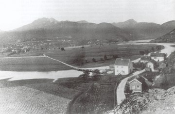
Sjøahola is the name of the first built-up area in Førde, and throughout several centuries it was the centre of the community, of communication, commerce, and administration. When the river Jølstra found a new course in 1780, it was the beginning of the end for Sjøahola, but the inn was in business until 1857, and the courthouse was moved only in 1902.
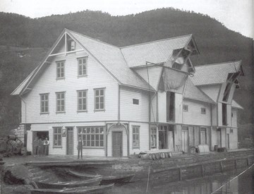
Steinen became the port of call for Førde. Several activities grew up here, for example the first manufacturing industries. Yet, like so many other boat stops, Steinen had its golden age only so long as the boat services operated regularly, and it has in our time lost its importance in Førde.
The island of Gåsvær is located far to the west in the sea between the Lågøyfjord and Gåsværosen in Solund. From the Lågøyfjord the one-kilometer-long island looks like a low strip of land. Gåsvær is believed to be the westernmost farm in the country. Although it is weather-exposed, the harbour is good. Some of the old buildings down by the sea are still intact.
Steinsundholmen is an islet in Indre Steinsund, the strait between Steinsundøy and Sula in Solund municipality. On this islet there were an inn and a general store. It was not a trading post on the same level as those in the fishing villages to the west, but the shop was in operation long after the inn had been closed down.
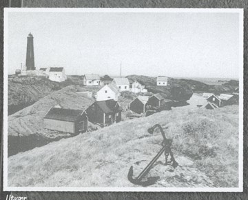
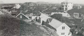
The chapel at Utvær was most likely built some time in the 12th century. It was consecrated to St Clement - the patron saint of sailors - and it was to serve sailors that the chapel was built. Utvær had a chapel until about 1717/1718, when a new chapel was built on the island of Husøy.
Rognaldsvåg is the main village on the island of Reksta, in the westernmost part of the municipality of Flora. The settlement on Reksta probably goes back 5000 years. Rognaldsvåg gradually became an important place because of the good harbour facilities, the proximity to the rich herring fisheries, and its central location. In 1860, Rognaldsvåg was the biggest built-up area along the coast of the county of Sogn og Fjordane.
On the northwest coast of Bremangerlandet - with the ocean as its neighbour, we find the deserted hamlet of Vetvik. Earlier this was a small rural community, but the last person left the hamlet in 1951.
On the western side of the farm Liset at Bremanger, there is a peaceful place. Only a few old foundation walls remain, bearing witness to hectic activity in former times, when hundreds of men "camped at Geitholmen". The seasonal use of the place goes back a long time, with the last climax during the spring herring fisheries in the mid-19th century.