

Borgund stave church is situated in the village of Borgund in the municipality of Lærdal. The church is said to be built about 1150, and is considered to be the best preserved of all the stave churches in Norway. The Society for the Preservation of Ancient Monuments (hence referred to as the Society) took over the ownership and management of the church in connection with the construction of a new church for the Borgund "sokn". This is the Norwegian stave church that attracts most visitors. The building of a new visitors' centre has now been started which will serve as an information centre and also ease the wear and tear caused by the many tourists in the old church itself.
In the autumn of 1941, German officers came to the point of Ospeneset on an inspection tour. Early in 1942, people in the area had to move from their farms, and shortly afterwards, the construction work was started.

By the school at Byrknesøy stands a memorial for eight men who lost their lives during the Second World War. They were all from Mjømna "sokn" (sub-parish). The memorial stone was unveiled on 17 May 1946.
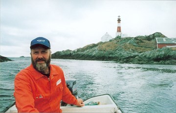
The Ytterøyane lighthouse, the biggest in Sunnfjord, was built in 1881, and has withstood hurricanes and airplane attacks. This lighthouse is one of very few along the coast that has not yet become automated.
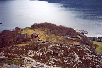
Clearly visible in the shipping lane of Ytre Steinsund, the trading post of Indrøy is situated. It is a striking example of how a self-made man built a many-sided business, which in turn was outstripped by new communications and a changed resource base.
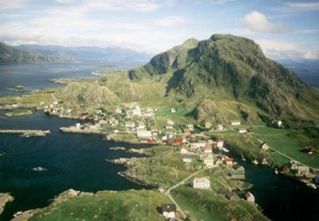
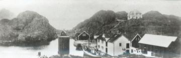
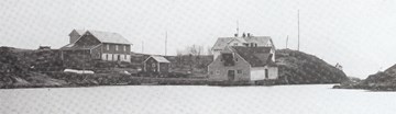
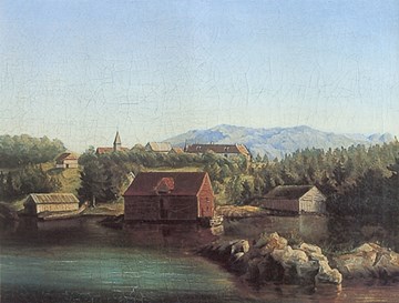
Rognaldsvåg is the main village on the island of Reksta, in the westernmost part of the municipality of Flora. The settlement on Reksta probably goes back 5000 years. Rognaldsvåg gradually became an important place because of the good harbour facilities, the proximity to the rich herring fisheries, and its central location. In 1860, Rognaldsvåg was the biggest built-up area along the coast of the county of Sogn og Fjordane.

In the year of culture 1997, the people of Bremanger decided that the old churchyard at Grotle should be the memorabilia of the county. The church of Grotle was taken down in 1865, but the churchyard was still used until 1902. In later years it has been standing untouched.

Berle church is a local church community centre in the village of Berle in the municipality of Bremanger. The church, which can seat 210 persons, was consecrated on 3 July, 1977, by the bishop Thor With. The architect Alf Apelseth from Ørsta made the designs. In 1977, Berle became a chapel district in the Rugsund "sokn" in the Davik parish. In 1981, Berle was transferred to Bremanger "sokn" in the parish of Bremanger. On 1 October, 1999, Berle "sokn" was established. Berle church is a "sokn" church for the Berle "sokn" in the parish of Bremanger.

Davik church is a wooden longchurch located in the village of Davik in the municipality of Bremanger. The church, with a seating capacity of 500, was consecrated on 6 July, 1886, by the bishop Fredrik Waldemar Hvoslef. The architect Georg Andreas Bull made the designs. Davik church is a "sokn" church for Davik "sokn" in the parish of Davik.
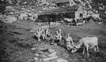
Until the 1920s, the villages of Allmenningen and Eldevika had a common mountain farm in Skogadalen in the former municipality of Davik. In the 1920s, the holdings at Eldevik built their own mountain farms further down in the vicinity of the lake of Sætrevatnet. Allmenningen had a spring and autumn cowshed at Branden. There was no place where they could stay overnight so they had to return home in the evenings. At Skogadalen they stayed overnight at the mountain farm, but they returned home during the day to take part in the work at the farm. It took from one to two hours to walk from the farm up to the mountain farm.
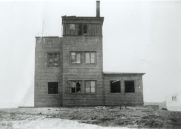
It is hard to believe that the Germans would build a signal station on the outermost point of Oddenova. The temptation became too great for the allies to let this bold monster operate freely.
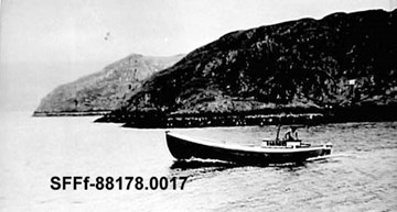
In early evening in the summer, a fleet of motor boats from western Solund headed west. Their destination was the numerous fishing grounds far out, where the young coalfish swam in huge shoals and took the bait willingly. The tools used were bamboo rods and home-made bait. This fishing method was called "påting".
Korssund is situated in the bay of Korssundosen, north of the Åfjord and south of the Vilnesfjord. With smaller boats it is possible to sail into the Vilnesfjord through the narrow strait of Lammetunsundet. There is also a road leading to this place, built in the 1960s. We still find a grocery shop and a post office at Korssund. From ancient times, Korssund was part of the municipality of Askvoll, but after the municipal border regulations in 1992, it now is part of the municipality of Fjaler.
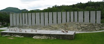
Gulatinget was the assembly site for the jurisdiction of western Norway. From the early 10th century and for a period of about 400 years, the assembly at Gulen played a key role in the judicial system of this part of the country.
Svanøy was in former times a central place in the outer Sunnfjord region with a bailiff's residence and a church of its own. On the old churchyard on the island stands a stone cross with a runic inscription. The cross bears resemblance to the cross at Korssund further to the south. According to legend, the cross is said to have been moved from Brandsøy.