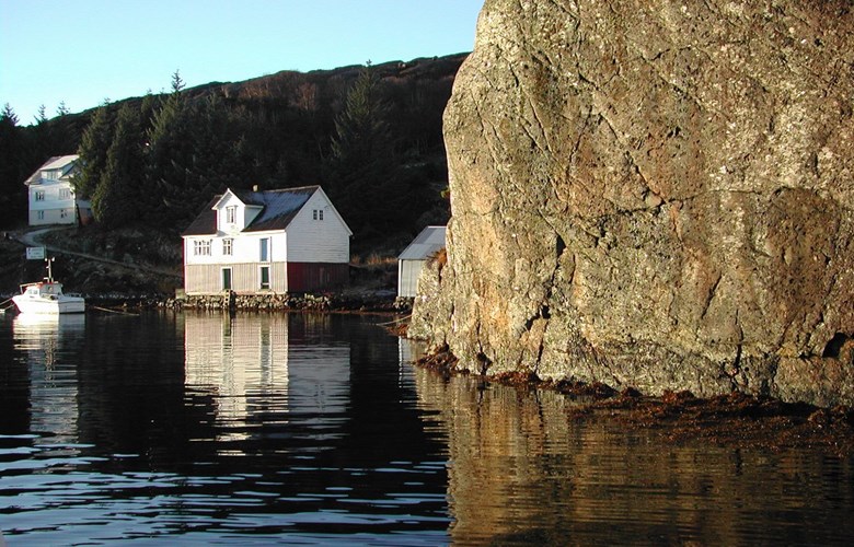
Locations and shape
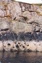
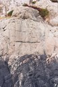
The water level marks can most often be found in or near the harbours to the west. They were chiselled into a rock with a wall as vertical as possible, at water level height. A rock wall in a sheltered spot with calm water was preferred. There the chisel work could be done without too much difficulty, and the high and low water levels could be measured in shelter of sea waves.
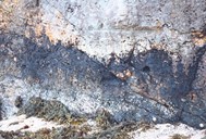
A horizontal groove was chopped into the rock, about one metre long and 3-5 centimetres deep and wide. Beside several of the marks, the year of the groove was chopped. In a few places the mark is only an iron bolt.

The purpose of the marks
The intention was that the distance between the mark and the shell or kelp belt, or the average water level, should be measured from time to time in the future. In this way it could be determined if the coast people were right when they claimed that "the sea drew back", or that "the land rose from the ocean". The issue was, then, whether there is a vertical movement between land and sea. The wish for clarity came from two quarters. The harbour authorities wanted to know if there was a danger of harbours and sea-lanes becoming shallower, and the Norwegian scientific community wanted to participate in the discussion. With time it was accepted that a certain land uplift was taking place also in Norway, but there were local variations along the coast.
"The water level mark at Noren Havn" (Nåra harbour)
In July 1889, the steamship of the lighthouse service, the "Blink", sailed into Nåra harbour and anchored. On the west side of the sound they found a suitable location for "the water level mark, which is a horizontal line, chopped into the rock, 90 centimetres long, five centimetres deep and five centimetres wide in the outer edge, placed 59 centimetres vertically above the kelp level". Directly above the mark a cross is chopped "whose arms are 23 centimetres long.". Into the kelp level a 30-centimetre-long groove is chiselled. A precise description such as this makes it easy the find the mark. The protocol is neatly entered in a beautiful handwriting and signed 18 July 1889, by lieutenant first class of the navy E. Hagerup.
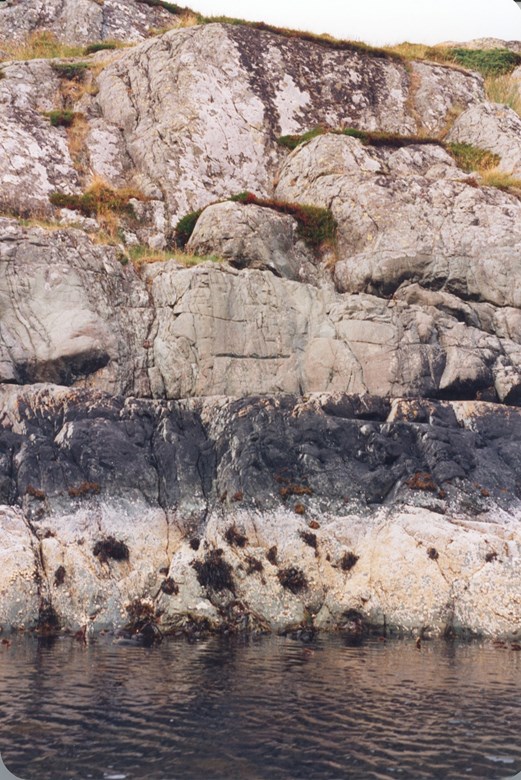
"The water level mark near Olderkalven"
The mark at Oddekalven was placed on 4 July 1891. Again the "Blink" with lieutenant first class Hagerup is at work. "The water level mark is placed on the eastern side of the islet of Fribergholmen near the middle of the narrow sound between this and Skarveklubben, on which a lighthouse is located." No vertical rock here, so the mark is on "a slanting mountain rock". The mark "chopped into the rock, a horizontal groove" is 78 centimetres long. The distance down to the level of shell is recorded exactly, as is how the measurements were taken, with "measurer and spirit level". The shell level is "straight horizontal with some loose bladder wrack above and below".
Surveillance of changes in shell and kelp belt
The first 28 marks were chopped in 1839. The initiative seems to have been taken by professor Keilhau, while the harbour and lighthouse inspector Schive took care of administration and the practical implementation. Control measurements can give information about height variation, and at the same time give insight into how shell and kelp have changed over time. Therefore, the Norwegian Mapping Authority has cooperated with the Marine Biological Institute in Bergen on the measuring. Annual measurements and photographs were planned for a ten-year period. Local people are asked to give a hand. The Norwegian Mapping Authority is constantly on the lookout for water level marks which have not been found. They believe that at least some marks may have been made when navigation marks were put up, and could therefore be in the neighbourhood of them.