The first road connection on the island of Frøya
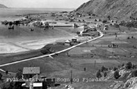
The first road to be built by public means in the old municipality of Bremanger was the road Steinset-Kalvåg-Frøynes on the island of Frøya in the period between 1907 and 1912. At that time, Kalvåg was the administrative centre in the municipality, and one of the biggest fishing villages in the county. A large number of fishing vessels were frequently gathered there. The road was built by means from the so-called "spring herring fund". It was the herring fishermen who demanded a road so they could get to the herring fishing grounds at Frøyskjera overland, when bad weather prevented them from getting there by boat.
Road building bit by bit
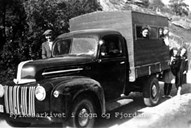
In the years 1920-1949 a number of rural roads were built at Bremangerlandet. Some of the roads were even built on a voluntary basis. The municipality allocated some means in advance, but most of the means came from relief work funds and means earmarked for roads in the coastal villages. The allocations were small, and, consequently, the road building did not make much progress. In 1927, the road between Dalsbotn and Kanalen was completed. In 1931, the road Kanalen-Førde-Fossane was completed.
The main western connection: Florø-Måløy
A main western connection between Florø and Måløy was projected for the distance Florø-Årebrotsvåg-Sørbotn-Smørhamn-Rydland-Førde-Dalsbotn-Oldeide-Måløy. In May 1935, the work was started on Dalsbotn-Oldeide, and in 1939, the section between Smørhamn and Rydland was started. This road construction was taken out of the road plan of 1921, but reintroduced later on because it was ideal for relief work. In addition, demands were put forward for a better connection to Måløy. Originally this road was planned as a rural road, but after a number of applications from the municipality of Bremanger, the road was built as a main road.
Connection to Måløy
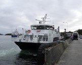
In 1949, the road was completed, and Bremangerlandet got its first overland scheduled bus connection between Bremanger and Oldeide and a ferry in the triangular connection Oldeide-Deknepollen-Måløy. This ferry connection was one of the first in Nordfjord. In 1956, the road between Rydland and Smørhamn was completed, with a bus connection between Bremanger and Smørhamn, where there was a boat connection to Florø. Bremangerlandet now had a continuous road from south to north. The road was later upgraded to highway (RV 616).
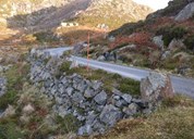
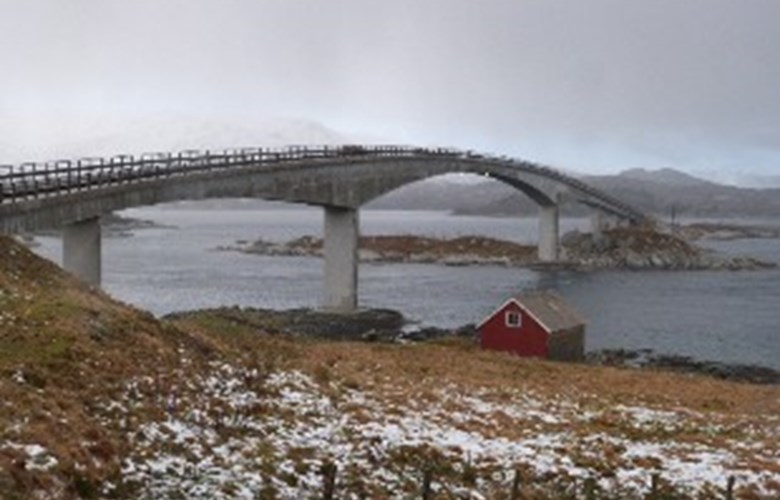
The road to Frøya
In the 1970s, about 1800 people lived at Bremangerlandet, and on the island of Frøya about 650. In January 1972, the construction of two bridges at Oldersundet and Hamrøy was started to link Frøya to the highway. In addition, a ferry quay was built at Smørhamn. The Minister of Transport and Communications, Ragnar Christiansen, cut the ribbon across the Oldersundet Bridge on 22 August 1977. The whole construction work cost NOK 20 million, and the road meant a new and vital incentive for the district.
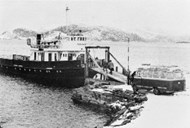
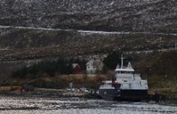
Ferry connection Smørhamn-Kjelkenes
In 1977, a ferry quay was built at Kjelkenes, which formed the basis for the connection Smørhamn-Kjelkenes-Florø (and partly Botnane). Florø was taken out of this connection in 1987, with the opening of a bridge across the Norddalsfjord. Admittedly, the ferry quay at Kjelkenes was not quite suitable. An old stone quay was used, and the cars had to drive onboard the ferry on two broad boards. Only in 1987 was a modern ferry quay built at Kjelkenes.