Anti-aircraft guns at Hovden
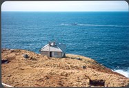
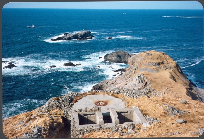
It was the German navy that built the anti-aircraft battery at Hovden, and the purpose was to protect their own ships and convoys along the sea lane around the point of Stad against allied air attacks. On all sides the mountain drops almost vertically down to the sea-level, and we can easily imagine how life must have been up there when the winds were howling. But this is where the Germans located four 105mm anti-aircraft guns, and further out at Litle-Hovden a searchlight and two 40mm guns. Through the mountain of Hovden there is a 100-metre-long tunnel, and from the end of the tunnel there was a cable railway down to Litle-Hovden where another, smaller tunnel was built. The main tunnel has a side tunnel of equal length ending in a shaft. The tunnels are open, and there is an information board by a track leading up to Hovden.
Some facts on the anti-aircraft battery at Hovden:
German name of the battery: Marine-Flak-Batterie 2./702 Ervik
Officers and crew: about 100
Main guns: Four German 105mm SKC/32 anti-aircraft guns
Camp for Russian prisoners of war at Ervik
Close to the road up to Hovden there was a camp for Russian prisoners of war that the Germans set to work at Hovden. This was hard work and many Russians lost their lives. These were temporarily buried close to the camp. After the end of the war the bodies were moved to the graveyard at the Ervik chapel, and the cross with the inscription "Here lie 21 Russians" has been kept. Later on the graves were moved to a special graveyard in Bergen for Russian POWs who died in Norway. No exact figures exist as to the number of Russians who were at Ervik, but the number could be between 100 and 120. The number of those who died there is also uncertain, but it could be between 21 and 32 POWs.
Radar station at Kjerringa
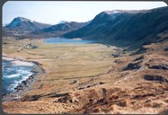
From Hovden we can see the "Vestkapphuset" on the mountain of Kjerringa, 497 metres above sea level. Up on this plateau the German Luftwaffe had a huge radar facility with four radar systems and technical equipment for air navigation and radio communication. The newest radar system was a "Wassermann" radar with a range up to 350 kilometres. In the chain of radar facilities built by the Luftwaffe along the coast, the Kjerringa facility was called Flugmelde-Zentrale (FMZ) "Steineiche". The purpose of the whole facility was aeroplane warning and support of their own planes. From the radar station there was radio communication with the main central at Fløyfjellet in Bergen (Herdla Airport), to Aukra west of Molde (Gossen Airport) and to other aeroplane report posts along the coast.

Modern facility destroyed
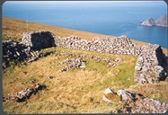
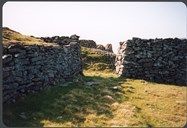
In 1945, this was a modern, advanced and expensive facility. The fear that the Germans themselves would destroy it at the capitulation proved to be unfounded. In June, 1945, the officer in charge of the Norwegian guard unit at Stadlandet, second lieutenant Dagfinn Aardal, was shown around the facility by the German commanding officer, and everything was then in order. After the Germans had handed over their radar facilities, an order was issued by the British military authorities that the facility was to be destroyed. The radar systems at Kjerringa were blown up, and later on all remnants removed from the premises. The walls built to protect barracks and equipment against the elements or any allied air attacks, are the only remnants left today.