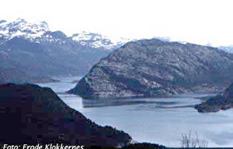
Mining in the Stone Age
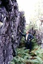
Across the point, there is a 500-600-metre-long gap of various depth and a width of two metres. Magma from the earth's interior has pushed up through cracks in the bedrock, which created flint-like border areas where the molten igneous rock has congealed rapidly against the adjacent cooler rock at the sides.
In this area, Brandsøy found huge quantities of diabase flakes spread over the shoreline on the western side of the point. He has also made a number of finds of early settlements in the Flora area, with raw material and flakes from Stakaldeneset.
The archaeologist Asle Bruen-Olsen wrote a Master's thesis on this subject. He writes that this stone axe quarry turned the Flora area into a centre for the hunting and fishing culture in the northern part of western Norway.
At this place, our forefathers have carried out a comprehensive quarrying operation to extract the rock diabase for more than four thousand years. This long time span is also unique for Stakaldeneset. We can envisage a stable community with a certain degree of specialization and division of labour, and with a commercial centre at Brandsøysundet, based on bartering with axes and raw materials from Stakaldeneset.
"One of its kind"
The Australian archaeologist Isabell McBryde is one of the many experts who have visited the site at Stakaldeneset in the years after the find. She is held to be the foremost expert on Stone Age quarries in our time, and she has said that this find is unique in Europe. It represents the earliest case of the fire-and- cold-water method used to extract rock in northern European quarries.
The Stakaldeneset diabase has a dark-green colour, with dull-white crystals. This characteristic feature makes it easy to distinguish tools from this diabase source from others found elsewhere. Analyses show that diabase axes from the Flora area are found from Bergen in the south to the Trøndelag coast in the north. Single specimens have also been found from Jæren to Nordland, and from the inland valleys of Gudbrandsdalen and Hallingdal. In our county as well as in Møre og Romsdal, the Stakaldeneset axes are predominant. In the county of Hordaland, greenstone axes from Hispriholmen to the west of Bømlo that are most numerous.
Quarrying for 4000-5000 years
In all, about 50 diabase dikes have been found in the Sunnfjord region, mostly in Flora. They differ from those found in the rest of the country by their chemical composition with an extremely high content of iron and titanium. The Stakaldeneset diabase dike is the only place where quarrying has been established, which means that there must have been something special about this rock that made it particularly suitable for tool-making.
In some places, the diabase dike has eight-to-ten-metre-high, vertical walls. It is the deep layer of sediments, consisting for example of charcoal and burnt rock that makes it possible to date the quarrying activities. According to Asle Bruen-Olsen, there has been a more or less continuous operation from about 6500 BC to 2000 BC.
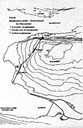
Three main quarries have been established; two down by the fjord on either side of the gap, and, strangely enough, one at the top at an altitude of about 135 metres, which must have made the extraction more cumbersome. One possible reason for this location could be that the rock quality was particularly good at the top.