
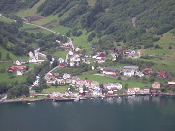
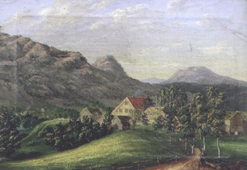
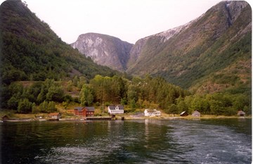
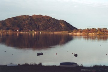
The Undredal farm is located on the western side of the Aurlandsfjord, five kilometres south of the entrance to the Nærøyfjord. The farm property covers and area of about 85 square kilometres, stretching southwest on either side of the valley of Undredalsdalen all the way the boundary with the municipality of Voss. The farm property also includes the mountainside north of the farmyard on the western side of the fjord, to the gully of Koldegjelet, as well as the mountainside on the east side of the fjord, to the boundaries of the farms of Kappadal and Nedbergo in the north.
The means of subsistence at Ytre Moa were based on the same natural resources that people have used until fairly recent times; the soil, the forest and the mountain areas. The house sites, the stonewalls and burial finds, coupled with the finds of objects and artefacts all bear witness to a varied use of the natural resources. The farm was deserted in the 10th century, probably because of lack of water. The area has never been cultivated since then, and the old farming complex from the Viking Age is consequently practically untouched. This has given us much new and surprising knowledge of the Viking Age in Norway.
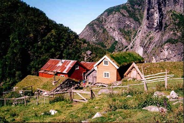
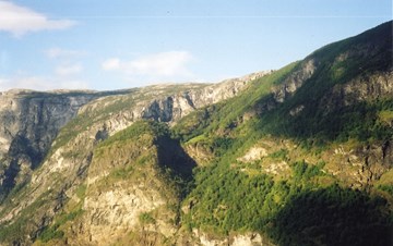
In the valley of Aurlandsdalen there are many deserted farms, and Sinjarhiem is one of these. The farm has a high location on a hill with gorges, canyons and waterfalls on all sides. In spite of the dramatic countryside people have made a living there for centuries. The farm was deserted in 1922 and decay gradually set in. In 1988, however, the buildings at Sinjarheim were restored by the Society for the Preservation of Norwegian Ancient Monuments and the farm is now used as a mountain farm by the Sogn Agricultural and Horticultural College in Aurland.
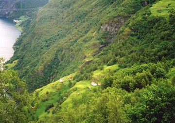
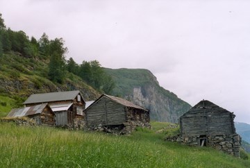
Stigen is located on the western side of the Aurlandsfjord, about 200 metres southeast of Beitelen and the entrance to the Nærøyfjord. The farm is located about 360 metres above sea level with a steep climb up from the fjord. There are several flat areas and ledges with good topsoil. The farm is surrounded by the fjord to the east, the gully of Koldegjelet to the south, and the mountain ridge between Beitelen and Stiganosi to the west. People on these two farms can make a relatively decent living there.
Nedbergo is located on the eastern side of the Aurlandsfjord, 300-400 metres northeast of Undredal. It is a steep climb up from the fjord, about 540 metres above sea level. There is a sloping cultivated field with good topsoil and good growth conditions, but the soil may become too dry. There are three mountain farms to the east and south in the mountains; "Heimestølen", Vassete og Nisedalen. The farm has hunting rights for deer and reindeer.
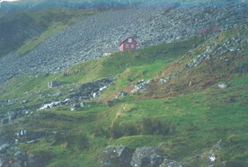
Horten is located on the eastern side of the Aurlandsfjord, about 560 metres above sea level, and about one kilometre north of Nedbergo. It is possible to walk up to the farm from the fjord at the outlet of the river Kotningdalselva. It is also possible to climb up from a place south of the farm. The farm is very small and not at all easy to get to. For most of the period of some 150 years from about 1700, people lived on the farm. From the mid-19th century, the farm was used as a hayfield by a farmer from Undredal.
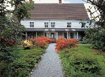
The bailiff farm at Bruland is held to be one of the best preserved examples of a high-ranking official¿s residence in western Norway. The main building in late baroque style dates from the 1750s, and it was moved to Bruland in 1789. It has been a listed building since 1924.
Of all the farms at Skei the captain farm Ytre Skei has been owned by public officials, most of them military officers, for the longest uninterrupted period, as many as 250 years. The main building has a long and diverse history, the oldest parts being more than 200 years old.
The vicarage in Førde has most likely always stood on the site where the old vicarage now stands, 350 metres south-east of the church, on the edge of a natural terrace. Today the old house is a lonely fairly isolated building between Førdehuset and the primary school, while the vicar now lives in the old bailiff house at Tåene.
The bailiff farm of Volden is the only residence for high-ranking public officials in Førde which is even today the residence of a public official. Now it is the vicar who lives here. The office building in the farmyard could be the very oldest house in the centre of Førde. Ten bailiffs resided at Volden from 1855 to 1971, and a well-known poet also lived there.
The Dyrdal farm is located down by the fjord on the northwest side of the Nærøyfjord and west of the river Dyrdalselva. The old farmyard lies on a terrace, about 200 metres from the fjord. Down by the sea and around the farmyard there were cultivated fields. On the hillside further up there were hayfields. From the farm the valley goes in a northern and western direction, leading up to a mountain farm area and hunting grounds.
The vicarage at Selje has long-established traditions dating back to the Middle Ages, with the first written reference about 1350. The old name of the farm was Hove.
Bø is the name of a farm on the eastern side of the island of Selja. Bø is one of the oldest farm names in Norway, indicating a big, central farm on a sunny location. Maybe Bø was formerly a royal farm. In the Middle Ages a "sokn" church was built on a flat area down towards the sea. In 1654, this church was moved to the mainland.
The Dyrstad farm is located on the western side of the Berstadvatnet lake in the valley of Berstaddalen, some 200 metres above sea level. The road leading up from the lake to the old house foundations is steep, and, according to old sources, the farm has been deserted several times because of rock slides and snow avalanches.
There are not many deserted farms left from the Iron Age in the county of Sogn og Fjordane. One of these is Kvernhusdalen in Selje. Measurements, C14 dating and pollen analyses from this place testify that there was a farm there both in the early and the late Iron Age.
The farm Årdal is located in a small valley close to the mountain of Liberra (470 m. a.s.l.) on the south side of Stadlandet. The distance to Selje is about five kilometres. The isolated farm is now deserted.
Throughout a period of nearly two centuries the farm of Tysse was the property of the upper middle-class families of Landmark and Lillingston.
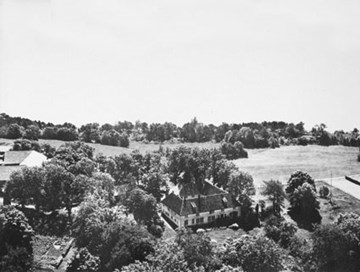
Furthest south at the entrance to the Førdefjord, with the Stavfjord to the south and the Brufjord to the north, lies the beautiful and fertile island of Svanøy. The island and the estate was originally known as Bru. For many years the estate held a central position in the region of Sunnfjord. In the 16th century, bailiffs lived on the island, and later on, in the 19th century, the lay movement of Hans Nielsen Hauge played a key role in the agricultural, industrial and religious development of the island.

Erikstad - locally pronounced er'sta - is located in the western part of Svanøy. The farmyard is situated a short distance up from the bay of Erstadvågen on the north side of the island. The farm has many old buildings and a number of enormous farmyard trees. Sheep graze in the fenced-in pastures, and horses can be seen on the premises.